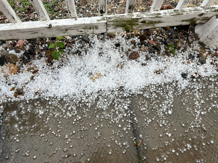
The Northern Tornadoes Project (NTP) says a supercell tornado touched down near Glencoe.
Officials said the tornado, with a preliminary rating of EF0, left a narrow path of damage just west of the town on Thursday, June 25.
EF0 tornadoes are on the weaker end of the scale, with wind speeds ranging from 90 to 130 kilometres per hour.
A damage survey team will visit the area today to determine a final rating, length, and maximum width, and document any downburst or hail damage that may have occurred during the storm.
Environment Canada issued a red tornado warning for Sarnia-Lambton just before 4:30 p.m. Thursday. The national weather agency said it was tracking a severe thunderstorm, possibly producing a tornado moving east of Sarnia. The warning for Sarnia ended just before 5 p.m.
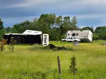
A red tornado warning was then issued for Chatham-Kent shortly after 7 p.m. when a storm cell capable of producing a tornado rolled through the region.
Areas in the path included Thamesville, Ridgetown, Highgate, and Rodney.
However, a tornado or downburst has not yet been confirmed there.